2.1 Why observe the Earth?
An improved understanding of the Earth System – of its weather, climate, oceans, land, geology, natural resources, ecosystems, and natural and human-induced hazards – is essential if we are to better predict and mitigate against the expected global changes and the impacts on human civilisation.
Data collected and information created from Earth observations constitute critical inputs to the exploration of sustainable management of the Earth – providing evidence for informed decision-making, supporting the science that underpins strategies for global environmental governance, and for monitoring our progress on all geographical scales.
The significance of Earth observations in our future decision-making processes is apparent in both:
- the long term: where high-quality information must be gathered continuously over many years in support of vital climate studies to:
- observe and characterise the current climate;
- detect climate change, determine the rate of change and assist in attributing the causes of change;
- identify the climate changes resulting from human activities;
- validate climate models and assist in prediction of the future climate;
- understand and quantify impacts of climate change on human activities and natural systems.
- the short term: where better information on every-day activities that support human existence will be a vital component of the global strategy for adaptation to a world with a rapidly increasing population, depleting natural resources, and experiencing the possible consequences of human-induced climate change; regions, countries, and industries can all be expected to be striving for improved efficiency and international competitiveness in agricultural production, freshwater management, land use management, atmospheric emissions control, natural resources exploration and management – including forests and fossil fuels, as well as in the prediction and mitigation of more frequent extreme weather events and natural disasters.
This information will be required on all scales – from local to global. We can anticipate that it might be used by intergovernmental bodies for decision-making and global governance to ensure sustainability, and also more locally as countries, regions, and industries compete for larger shares of smaller reserves of natural resources in order to support their growing populations and economic ambitions. Such information takes many forms, spanning data on population, demographics, economics, and environmental indicators. Observations of planet Earth itself, of man’s environment, might be regarded as the most important of all, as the context for all decisions.
Earth observing systems help to provide data in support of a wide range of information needs, on Earth parameters which are central to:
- improved understanding: with a multitude of global scale observations contributing to research into Earth System processes;
- evidence: Earth observations support the formulation of authoritative scientific advice – which is vital for governments when deciding to fund mitigation measures in response to global change, to react to impending crises in resource shortages, or to participate in agreements or conventions which require costly changes in national consumption patterns;
- monitoring and compliance: we might expect to see increasing emphasis on international policy measures and treaties such as the Kyoto Protocol emerging in the future; Earth observations will play an essential role in monitoring such agreements, ensuring that countries meet their legal obligations in relation to challenges like reductions in fossil fuel emissions, or pollution dumping.
The economic implications of such agreements can be enormous for countries and highly visible and public measures to deter ‘cheating’ will be an important part of their success;
- management and mitigation: in support of increased efficiency in providing basic resources for future generations and in predicting and countering the worst effects of severe weather and natural disasters.
The beneficiaries will be a broad range of global user communities, including: national, regional, and local decision-makers; organisations responsible for the implementation of international conventions and treaties; business, industry, and service sectors; scientists and educators; and, of course, every inhabitant of planet Earth.
2.2 The GEO Initiative
In what might be considered as a first step towards establishment of the Earth observations component of a far-sighted scheme for global environmental governance, high-level officials from 33 countries, from the European Commission, and from 21 international organisations involved in Earth observations, convened in Washington DC, USA on 31st July 2003 to attend the ‘First Earth Observation Summit’.
Recalling the urgent need expressed by the World Summit on Sustainable Development (WSSD – Johannesburg 2002) for coordinated observations relating to the state of the Earth, these governments and organisations adopted a Declaration signifying a political commitment to move toward development of “a comprehensive, coordinated, and sustained Earth observation system”.
The Summit established the ad hoc intergovernmental Group on Earth Observations (GEO), co-chaired by the European Commission, Japan, South Africa and the United States of America, and tasked it with the development of an initial 10-Year Implementation Plan by February 2005. The 2nd EO Summit (Tokyo, April 2004) developed a 'Framework Document' to guide this process.
The Plan will define the operating principles, institutions and commitments relating to the establishment of a Global Earth Observation System of Systems (GEOSS). The Group envisages that GEOSS will be:
- comprehensive, by including observations and products gathered from all components required to serve the needs of participating members;
- coordinated, in terms of leveraging resources of individual contributing members to accomplish this system, whose total capacity is greater than the sum of its parts;
- sustained, by the collective and individual will and capacity of participating members.
GEOSS will be a distributed system of systems, building step-by-step on current cooperation efforts among existing observing and processing systems within their mandates, while encouraging and accommodating new components. Participating members will determine ways and means of their participation in GEOSS.
Nine topics were identified on which there was agreement that clear societal benefits could be derived from a coordinated global observation system:
- reducing loss of life and property from natural and human-induced disasters;
- understanding environmental factors affecting human health and well being;
- improving management of energy resources;
- understanding, assessing, predicting, mitigating, and adapting to climate variability and change;
- improving water resource management through better understanding of the water cycle;
- improving weather information, forecasting, and warning;
- improving the management and protection of terrestrial, coastal, and marine ecosystems;
- supporting sustainable agriculture and combating desertification;
- understanding, monitoring, and conserving biodiversity.
It is anticipated that each societal benefit area will evolve over time and that others may be added in due course.
The rationale for GEOSS is that collective action is needed to bring operational observing systems in line with the requirements for addressing a range of issues of concern to society; and that we are currently not getting full value from the substantial investment (of the order of tens of billions of euros per year in total) already made in Earth observation. This results from the lack of systematic implementation, coordination, data exchange and attention to information systems that meet user needs.
The global, comprehensive, integrated and sustained effort outlined in the GEOSS 10-Year Implementation Plan aims to address such shortcomings in the following ways:
- agreements on system interoperability and data sharing: thereby increasing the number and type of observations available for analysis, as well as their spatial and temporal coverage, while only marginally increasing the cost of data provision. GEOSS provides a mechanism through which partial or full data sharing can be negotiated and a technical process by which it can be achieved;
- collective optimisation of the observation strategy: using cooperation to avoid redundancies in sampling, and gaining synergies and cost savings by using observational infrastructure for multiple purposes;
- cooperative gap filling: for example, in overcoming national difficulties in justifying certain observations for local benefit, and ensuring monitoring of regions outside the territory of individual nations (such as the open oceans and Antarctica);
- commitments to observational adequacy and continuity: a fundamental commitment to continuation of observations at an acceptable level of accuracy and coverage is essential for realisation of all the benefits envisaged for GEOSS.
The ad hoc GEO process is scheduled to conclude its work with the 3rd EO Summit, to be held in Brussels, where it is expected that an international mechanism (to be known as GEO - without the ad hoc) will be established to take forward an agreed 10-Year Implementation Plan and to serve as a focus for cooperation efforts.
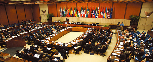
The First Earth Observation Summit
Declaration of the Earth Observation Summit
We, the participants in this Earth Observation Summit held in Washington, DC, on July 31, 2003:
Recalling the World Summit on Sustainable Development held in Johannesburg that called for strengthened cooperation and coordination among global observing systems and research programmes for integrated global observations;
Recalling also the outcome of the G-8 Summit held in Evian that called for strengthened international cooperation on global observation of the environment;
Noting the vital importance of the mission of organizations engaged in Earth observation activities and their contribution to national, regional and global needs;
Affirm the need for timely, quality, long-term, global information as a basis for sound decision making. In order to monitor continuously the state of the Earth, to increase understanding of dynamic Earth processes, to enhance prediction of the Earth System, and to further implement our environmental treaty obligations, we recognize the need to support:
(1) Improved coordination of strategies and systems for observations of the Earth and identification of measures to minimize data gaps, with a view to moving toward a comprehensive, coordinated, and sustained Earth observation system or systems;
(2) A coordinated effort to involve and assist developing countries in improving and sustaining their contributions to observing systems, as well as their access to and effective utilization of observations, data and products, and the related technologies by addressing capacity-building needs related to Earth observations;
(3) The exchange of observations recorded from in situ, aircraft, and satellite networks, dedicated to the purposes of this Declaration, in a full and open manner with minimum time delay and minimum cost, recognizing relevant international instruments and national policies and legislation; and
(4) Preparation of a 10-year Implementation Plan, building on existing systems and initiatives, with the Framework being available by the Tokyo ministerial conference on Earth observations to be held during the second quarter of 2004, and the Plan being available by the ministerial conference to be hosted by the European Union during the fourth quarter of 2004.
To effect these objectives, we establish an ad hoc Group on Earth Observations and commission the group to proceed, taking into account the existing activities aimed at developing a global observing strategy in addressing the above. We invite other governments to join us in this initiative. We also invite the governing bodies of international and regional organizations sponsoring existing Earth observing systems to endorse and support our action, and to facilitate participation of their experts in implementing this Declaration.
(Adopted 31 July 2003) |
| GEO Members |
Algeria
Argentina
Australia
Belgium
Belize
Brazil
Cameroon
Canada
Central African Republic
Chile
China
Croatia
Cyprus
Denmark
Egypt
Finland
France
Gabon
Germany
Greece
Guinea-Bissau
India
Indonesia
Iran
Ireland
Israel
Italy |
Japan
Kazakhstan
Latvia
Luxembourg
Mali
Mexico
Morocco
Mozambique
Nepal
Netherlands
New Zealand
Nigeria
Norway
Portugal
Republic of the Congo
Republic of Korea
Russian Federation
South Africa
Spain
Sudan
Sweden
Switzerland
Thailand
Ukraine
United Kingdom
United States
Uzbekistan |
| GEO Participating Organisations |
ADIE
CCAD/SICA
CEOS
ECMWF
EEA
ESA
EUMETNET
EUMETSAT
European Commission
FAO
FDSN
GCOS
GEO Secretariat
GOOS
GTOS
IAG
ICSU
IEEE |
IGBP
IGFA
IGOS-P
IISL
IOC
ISCGM
ISDR
POGO
UNCBD
UNCCD
UNEP
UNESCO
UNFCCC
UNOOSA
WCRP
WMO
World Bank (IBRD) |
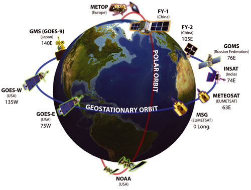
2.3 Existing observing systems
As a ‘system of systems’ GEOSS will encompass a broad range of existing and planned networks of satellite-borne and Earth-based sensors, including ocean buoys, weather stations and atmospheric radiosondes – providing important parameters relating to land, ocean, and atmospheric processes. It has long been recognized that the range of observations, many of which are global, needed to understand and monitor Earth System processes and to assess the impact of human activities cannot be satisfied by a single programme, agency, or country. The main Earth observing networks are therefore typically international collaborative programmes by nature, and include:
World Weather Watch
The best known of these networks may be the World Weather Watch (WWW) of the World Meteorological Organization (WMO). The WWW is a unique achievement in international cooperation, providing a truly world-wide operational system to which virtually every country in the world contributes, every day of every year, for the common benefit of humankind.
The Global Observing System (GOS) of the WWW - which includes around 10,000 stations on land providing observations near the Earth’s surface, at least every three hours, of meteorological parameters such as atmospheric pressure, wind speed and direction, air temperature and relative humidity – ensures that every country has all the information available to generate weather analyses, forecasts and warnings on a day-to-day basis. The most obvious benefits of the GOS are the safeguarding of life and property through the forecasting, detection and warning of severe weather phenomena such as local storms, tornadoes, and tropical cyclones. GOS provides observational data for agricultural management, aviation safety, meteorology and climatology, including the study of global change. These observations also provide an international database of upper air observations for research purposes.
22 Global Atmosphere Watch (GAW) stations world-wide supplement these observations with information on ozone, other greenhouse gases, solar radiation, UV, and other atmospheric and meteorological parameters.
The Global Observing Systems
Within the last decade, the Global Observing System of the World Weather Watch has been complemented by the Global Ocean Observing System (GOOS) and the Global Terrestrial Observing System (GTOS) to produce a set of Global Observing Systems integrating in-situ and remotely sensed data from a range of international, regional and national observing systems and networks, with each focusing on a major component of the Earth System. The Global Climate Observing System (GCOS) has also been planned and initiated to integrate the observing needs for climate purposes.
GOOS: GOOS is a permanent global system for observations, modelling and analysis of marine and ocean variables to support operational ocean services worldwide. GOOS will provide accurate descriptions of the present state of the oceans, including living resources; continuous forecasts of the future conditions of the sea; and the basis for forecasts of climate change. GOOS is capitalising on existing ocean observing systems, such as:
- The TAO/TRITON array: comprises 70 moored buoys in the Tropical Pacific Ocean, which since its completion in 1994 has enabled real-time collection of high quality oceanographic and surface meteorological data for monitoring, forecasting, and understanding of climate swings associated with El Niño and La Niña. Data and graphic displays from the TAO/TRITON array are updated every day, and the data are freely available to the research community, operational forecasting community, and the general public.
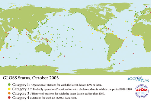
- The Global Sea Level Observing System (GLOSS): an international programme coordinated by the Intergovernmental Oceanographic Commission (IOC) for the establishment of high quality global and regional sea level networks for application to climate, oceanographic and coastal sea level research. The main component of GLOSS is the 'Global Core Network' (GCN) of 290 sea level stations around the world for monitoring long term trends and accelerations in global sea level.
There are numerous other contributors to GOOS, including: voluntary observing ships providing measurements of upper ocean and meteorological parameters; the Global Temperature and Salinity Profile Programme; and the Global Coral Reef Monitoring Network.
GTOS: GTOS is a programme for observations, modelling, and analysis of terrestrial ecosystems to support sustainable development. GTOS facilitates access to information on terrestrial ecosystems so that researchers and policy makers can detect and manage global and regional environmental change.
To achieve this GTOS is working towards the establishment of a “system of networks", formed by linking existing terrestrial monitoring sites and networks as well as planned satellite remote sensing systems. Thematic networks have been established for ecology, glaciers, and permafrost, and a hydrology network is in progress.
Since the sustainable development of forest resources is regarded as one of the most pressing environmental issues of our time, GTOS has established a panel on Global Observations of Forest Cover and Land Cover Dynamics (GOFC-GOLD) which aims to improve the quality and availability of observations of forests at regional and global scales and to produce useful, timely and validated information products from these data for a wide variety of users.
The Global Terrestrial Network (GT-Net) links the world's terrestrial research networks together. It serves as a framework for network managers to explore areas of common interest, harmonize research efforts and share data, information and experience.
GCOS: GCOS was established in 1992 to ensure that the observations and information needed to address climate-related issues are obtained and made available to all potential users. It is co-sponsored by WMO, the IOC, the United Nations Environment Programme (UNEP) and the International Council for Science (ICSU). GCOS is intended to be a long-term, user-driven operational system capable of providing the comprehensive observations required for monitoring the climate system, for detecting and attributing climate change, for assessing the impacts of climate variability and change, and for supporting research toward improved understanding, modelling and prediction of the climate system. It addresses the total climate system including physical, chemical and biological properties, and atmospheric, oceanic, hydrologic, cryospheric and terrestrial processes.
GCOS does not itself directly make observations nor generate data products. It stimulates, encourages, coordinates and otherwise facilitates the taking of needed observations by national or international organisations in support of their own requirements as well as of common goals. It provides an operational framework for integrating, and enhancing as needed, observational systems of participating countries and organisations into a comprehensive system focussed on the requirements for climate issues.
GCOS builds upon, and works in partnership with, other existing and developing observing systems such as the Global Ocean Observing System, the Global Terrestrial Observing System, and the Global Observing System and Global Atmospheric Watch of the WMO.
The Integrated Global Observing Strategy Partnership
The Integrated Global Observing Strategy Partnership (IGOS-P) was established in June 1998 by a formal exchange of letters among the 13 founding Partners for the definition, development and implementation of the Integrated Global Observing Strategy (IGOS). The principal objectives of the IGOS are to address how well user requirements are being met by the existing mix of observations, including those of the global observing systems, and how they could be met in the future through better integration and optimisation of remote sensing (especially space-based) and in-situ systems.
The IGOS serves as guidance to those responsible for defining and implementing individual observing systems. Implementation of the Strategy, like the establishment and maintenance of the components of an integrated global observing system, lies with those governments and organisations that have made relevant commitments, for example, within the governing councils of the observing systems' sponsors.
To aid the development of the Strategy, the Partners have adopted an incremental "Themes" approach based on perceived priorities. The Ocean Theme was the first IGOS Theme report to be approved and published – in January 2001. Since then a number of other Themes have been developed, or are in progress:
- Global Carbon Cycle;
- Geo-hazards;
- Global Water Cycle;
- Atmospheric Chemistry;
- Coastal Zones/Coral Reefs;
- Land;
- Cryosphere.
The IGOS Themes represent a strong foundation in international cooperation for the future efforts of GEOSS. Further information on IGOS-P and the IGOS Themes is presented in annex B.
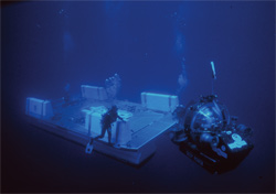 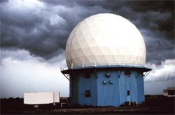
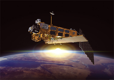
A multitude of in-situ and space-based sensors contribute to Earth observations
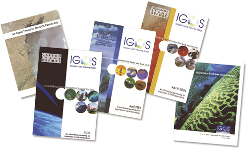
IGOS Theme Reports
BACK TO TOP |