Satellite observations contribute to the production of timely agricultural yield and market information, supporting the effort to limit extreme food price volatility. Satellite measurements can be used to produce baseline maps of crop areas, crop types and growing season calendars. Satellite observations can help detect soil moisture anomalies and even contribute to crop condition assessment; based on these observations, modelling techniques can be employed to forecast yield production and derive market information.
Satellite-based observations used in concert with unmanned aerial vehicles (UAVs) can also support sustainable agriculture via increased production efficiency and crop yields. Precision farming approaches using GPS have been adopted by agricultural sectors in large parts of the world. Associated yield efficiencies can spread as capacity increases and the cost of technology decreases.
Improving market effectiveness through transparency
In response to volatility in global food prices, in 2011 the G20 Heads of State endorsed the creation of the Agricultural Market Information System (AMIS), to be supported by the Group on Earth Observations Global Agricultural Monitoring initiative (GEOGLAM). This included a commitment to improve the effectiveness of the market for agricultural commodities via increased information and transparency.
GEOGLAM produces monthly Crop Monitor assessments for 20 AMIS countries that are used by: economists focused on providing early warning of food price shocks and volatility; agricultural ministries; members of industry and research organisations. A Crop Monitor for Early Warning has been developed to identify areas of emerging food supply stress, to support proactive policy decisions and actions and improve the functioning and efficiency of agricultural markets. These reports are generated routinely for a further 40 countries deemed to be vulnerable to crop failures.
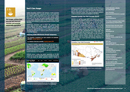
Integrated Canadian Crop Yield Forecaster (ICCYF)
Agriculture and Agri-Food Canada (AAFC) is an extensive user of Earth observation data for operational monitoring, looking at agricultural land use, land management practices, soil moisture, near real-time crop condition and monthly crop yield estimates. This information is used across the Canadian government and by industry and researchers. AAFC has worked with Statistics Canada (STC) to develop the Integrated Canadian Crop Yield Forecaster (ICCYF) that integrates climate information, remote-sensing data and other available information (e.g., historical yields, soil maps, EO-derived crop maps) using a physically-based soil moisture budget model and a statistically-based yield forecasting model. In 2016, ICCYF made Canada the first country to release model-based crop yield estimates as official statistics, replacing traditional September farm surveys. It has been recognised across the Canadian community and government as a showcase of the power of Earth observation technology, collaboration and innovative thinking.