Ocean Colour Instruments
Description
Ocean colour radiometers and imaging spectrometers measure the radiance leaving marine waters in the visible and near-IR spectrum in the range 400–800 nm, where the colour is characterised by the constituents of the water – typically phytoplankton, suspended particulate material and dissolved compounds. Differences in the intensity of light received in the different bands give information on the concentration of a variety of substances present in the ocean. Radiance measurements may be affected by Sun glint, since observations at subtropical latitudes are contaminated by the bright pattern of the specular reflection of the Sun by the wavy sea surface.
Ocean colour instruments have very narrow detection channels, around 10 nm wide, to measure fine spectral details. The spatial resolution of these instruments is typically 0.3-1 km. The more recent ocean colour instruments have improved spatial, spectral and radiometric resolution. The trend towards multi-channel, multi-purpose sensors, such as MODIS and MERIS, is resulting in more instruments with an ‘ocean colour’ capability. Most ocean colour instruments have been flown on low-orbit satellites. However, a new sensor (GOCI) was launched in 2010 on a geostationary platform (COMS), thus allowing the frequent acquisition of data suitable for the monitoring of rapid events, e.g. coastal currents, algal blooms or floods – but with limited coverage.
Significant calibration and validation activities, together with algorithm development for ocean colour instruments, continues, particularly with respect to measuring ocean productivity.
Applications
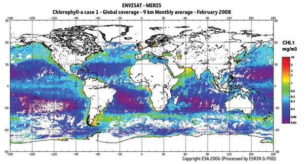
The colour of the oceans as seen from space reveals phytoplankton pigment concentration (chlorophyll), which is used as an indirect measurement of ocean biomass and its associated productivity. These parameters are of considerable oceanographic and climatological significance, since oceanic productivity ‘drives’ the air-to-sea exchange of biogenic greenhouse gases (e.g. CO2).
Ocean colour imagery can also be used in support of fisheries management or protection, for example through identification of biologically rich areas. Other data that may be inferred from ocean colour measurements include information about suspended matter (useful in coastal studies), biological productivity, marine pollution and water dynamics (eddies, currents, etc.) in coastal zones.
|
 |
| |
|
|
| Current & planned instruments |
| Advanced GOCI |
|
OCM |
|
|
| CZS |
OCM (Oceansat-3/3A) |
|
|
| GOCI |
OCS |
|
|
| MERIS |
OES |
|
|
| MODIS |
OLCI |
|
|
| Multi-band UV/VIS Spectrometer (ACE) |
SGLI |
|
|
| MUS-L |
VIIRS |
|
|
| MUS-M |
|
|
|
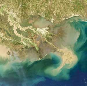
MODIS view of Mississippi river delta in February 2008 showing flows of sediments and nutrients.
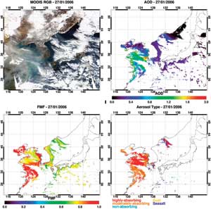
GOCI example product.
|
|