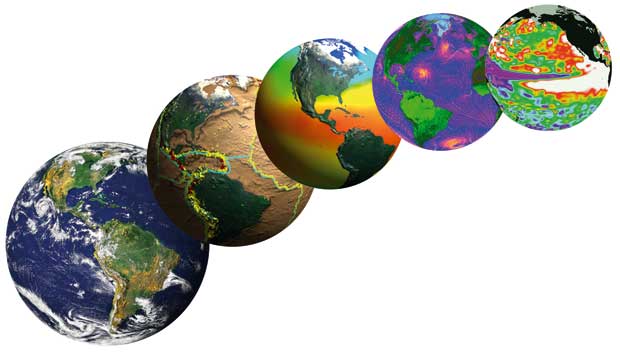
The development and operation of space vehicles, launchers and instruments are highly technical endeavours that are generally delegated by national governments to specialised space agencies. A typical space agency has responsibility for overseeing all aspects of the space activities of its host national or regional government. Applications of Earth observation satellite programmes are typically numerous and diverse, including, but not limited to, studies of climate, environmental issues, agriculture, meteorology and natural disasters.
More information on the important role of CEOS in this framework is provided in section 3. In broad terms, CEOS membership comprises two classes of space agencies:
− research agencies, which typically undertake cutting-edge R&D activities, often involving ‘one-off’ Earth observation missions that are intended to demonstrate a technical concept of measurement capability in support of well-identified science objectives; and
− operational agencies, which are funded by governments to make continuous and time-critical observations, ensuring that there are no temporal or spatial gaps in coverage. A limited number of space agencies fall into this operational category.
Support to the major environmental conventions requires a commitment to stable and continuous measurements over long time periods, but, to date, issues such as data and mission continuity, overlap and cross-calibration have been undertaken by research agencies on a ‘best efforts’ basis. While a typical mission involves considerable effort dedicated to these activities,
there remains a need to ensure that this happens systematically. In recent years, agencies have endeavoured to ensure continuity of some key measurements (e.g. ocean surface altimetry) that have become established as near-operational within some user communities. This remains, however, the exception rather than the rule for research-oriented space agencies, which are neither mandated nor funded to provide operational services.
In contrast to research-focused satellite programmes, the satellite programmes of operational agencies are designed to ensure constant interaction with operational user communities and adaptation to their needs, as well as sustained, overlapping and coordinated coverage. There is growing recognition of the need for such planning and continuity to be a feature of more satellite Earth observations, and the Global Monitoring for Environment and Security (GMES) programme of the European Space Agency and European Commission seeks to address this very challenge by providing continuity of key land, sea and air measurements for at least 20 years by the Sentinel series of satellites.
The international endeavour to ensure optimal coordination of available financial and technical resources within national satellite Earth observation budgets has come a long way since the Rio Summit in 1992. The first CEOS Earth Observation Handbook was a milestone in documenting the plans and programmes of civil space agencies worldwide, with the view to understand the capabilities and capacities of different countries and their space agencies, and what the outlook was with regards to harmonisation of these plans such that unnecessary overlaps and measurement gaps could be avoided.
Improved technology
The 20 years since Rio have seen substantial technical improvements in relation to the observations provided by CEOS space agencies:
- a larger number of observations are now possible, unlocking essential new information derived from parameters such as soil moisture, concentrations of different atmospheric gases and pollutants, inland water levels, carbon stocks in vegetation and precipitation estimation;
- new technologies, such as cloud radars, lidars (light detection and ranging instruments), radio-occultation sounders, hyperspectral imagers, gravity-field sensors and scatterometers, are adding to the possibilities of remotely sensed information from space;
- improved technologies, computing power and modelling capabilities have led to higher accuracy, confidence and increased stability in measurements from space. These advances have been consolidated by increased experience in calibration of space measurements with in situ systems and with other satellite sensors.
Improved Coordination Frameworks
Institutionally, the agencies engaged in planning and providing satellite Earth observations in support of society’s challenges have also come a long way. In 1992, CEOS was still in relative infancy and was yet without a systematic approach to plan and monitor progress towards globally coordinated observations. Key milestones along the way have included:
- emergence of the IGOS (Integrated Global Observing Strategy) Partnership in the late 1990s as a comprehensive framework to harmonise the common interests of the major space-based and in situ systems for global observation of Earth. IGOS was developed as an over-arching strategy for conducting observations relating to climate and atmosphere, oceans and coasts, the land surface and Earths interior.IGOS sought to build upon the strategies of existing international global observing programmes, and upon current achievements. IGOS provided a new mechanism for the expression of the information requirements for major user communities (organised around Themes like the Water Cycle, Cryosphere and Oceans) and for the development of the dialogue around the fulfilment of those requirements by the agencies planning Earth-observing systems;
- development of the CEOS Response to the GCOS Implementation Plan (2006, updated in 2010). The GCOS Implementation Plan (and in particular the special supplement on satellite observations, also updated 2010) noted that satellites provide a vital means of obtaining observations of the climate system from a global perspective, and that “a detailed global climate record for the future will not be possible without a major, sustained, satellite component”. Noting GCOS advice on the significance of the satellite contribution to climate data records, the UNFCCC invited countries that support space agencies which operate Earth-observing satellite programmes to provide a response to the needs expressed in the GCOS Implementation Plan. These countries agreed that CEOS, as the primary international forum for coordination of space-based Earth observations, was the appropriate international body to respond. CEOS prepared and delivered to the UNFCCC an assessment of the adequacy of past, present and future satellite measurements in support of GCOS. CEOS noted that responding to these needs represents a unique opportunity for space agencies to review the way in which multi-agency cooperation on climate-related observations is prioritised, agreed, funded, implemented and monitored. The UNFCCC has welcomed the CEOS initial report, commended space agencies for actions taken thus far and requested CEOS to report on progress at future meetings;
- establishment of GEO and the definition of GEOSS as an effective mechanism for focusing the Earth observation community in support of common strategic targets addressing societal needs. The IGOS Partnership transitioned into the GEO framework, making GEO the most important coordination body for dialogue between information users and data providers, and – through the GEO Work Plan – for the systematic monitoring of progress towards the GEOSS targets.
GEO provided a genuine sense of purpose and formal mechanism for the establishment of targets against which coordination efforts in CEOS could be gauged.
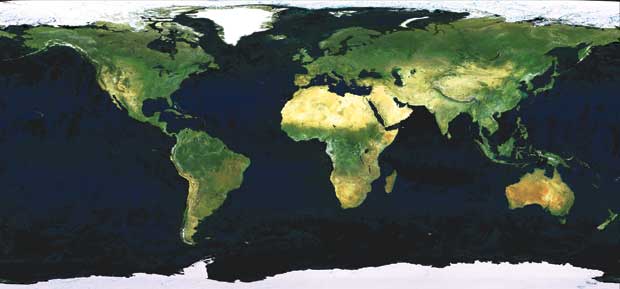
GlobCover mosaic of MERIS.
As the body responsible for the GEOSS space segment, CEOS is the largest single contributor of resources and progress towards the GEO Work Plan. CEOS has reorganised itself so that it is more systematic and comprehensive in its coordination activities – in response to the GEO targets. A series of CEOS Virtual Constellations have been defined to provide mechanisms for accelerated coordination towards high-priority GEO targets.
International engagement in CEOS has expanded considerably over the last two decades, with membership of space agencies increasing from 14 in 1992 to 30 in 2012 – including every major civil Earth observation programme globally. Accordingly, significantly greater capacity is being applied within CEOS, consistent with a mature collaboration framework with a systematic and comprehensive approach to its mandate. The information tools at its disposal, which include the database of missions, instruments and measurements – updated at least annually – provide CEOS with the necessary resources in support of the harmonisation of the programmes and plans of its agencies.
Improved Data Access
In combination, communication technologies and more open data policies of governments funding satellite Earth observation have resulted in a significant increase in the availability and accessibility of the data since 1992. Many important data archives are available online and accessible to users worldwide. In 2008, the United States Geological Survey (USGS) announced free online availability for its entire multi-decadal Landsat data archive – and more than one million scenes have since been downloaded by users worldwide. Brazil has long been a proponent of public data policy and its CBERS series of missions developed and operated in cooperation with China are recognised as a model for the benefits that result from free and open provision of Earth observation satellite data. The European Space Agency (ESA) has in recent years provided an increasing amount of data from its Earth observation satellites available online and free of charge. ESA’s stated objective is to apply a free-of-charge, readily available data policy for the next generation of Earth observation missions being developed and operated with the European Commission.
Recognition of the pressing need for open data supply in support of coordinated action towards some of humankind’s most pressing challenges has resulted in effective data-sharing mechanisms beyond those that have been pioneered for meteorology:
- The International Charter ‘Space and Major Disasters’: provides a unified operational system
of space data acquisition and delivery to those affected by natural or man-made disasters through key national agencies. Each member agency has committed resources to support the provisions of the Charter and thus is helping to mitigate the effects of disasters on human life and property. More than 300 activations have been implemented since its establishment in 2000, in support of some of the world’s worst natural disasters such as in Japan (March 2011) and Haiti (January 2010). The number of activations continues to increase every year. Most major space agencies and commercial satellite data operators work together effectively through the Charter framework;
- Global Forest Observations Initiative (GEO–GFOI): emissions from forests amount to almost 20% of all global greenhouse gas emissions. National governments are therefore making significant investments to reduce emissions from deforestation, forest degradation and associated land use change. GFOI seeks to foster the sustained availability of observations for national forest monitoring systems and assist countries to make the best use of these observations. CEOS space agencies have coordinated data acquisitions since 2008 to ensure national forest mapping coverage
of demonstrator countries, with a view to establish sustained global coverage annually from around 2013 or 2014 – contributing to the inclusion of forest carbon resources in future climate treaties and emerging carbon markets;
- Similar initiatives to ensure supply of essential satellite data are underway in support of the G20 action plan to address food price volatility and to develop global agricultural market information systems that will collect information on stocks, and the supply and demand of crops. The GEO Global Agricultural Monitoring initiative (GEOGLAM) brings together existing national and regional monitoring systems to establish a ‘system of systems’ for monitoring global agricultural production and food security. This will require making these systems more compatible and interoperable, promoting common data standards and strengthening transparency and data sharing. Satellite data coordination mechanisms pioneered for GFOI will be adapted and expanded in support of this strategic endeavour. The initiative
will address the particular priorities of countries at
risk, such as sorghum production in western Africa.
It will enhance national capacities for using Earth
observations for monitoring crops and promoting
food security.
Further information on the role of CEOS is provided
in Section 3. Section 4 highlights the challenges that lie ahead if we are to successfully address the
challenges first identified by the Rio Earth Summit,
and being debated again in Rio in 2012.
Some examples of the vital contribution of Earth
observation satellites in support of major
environmental and societal challenges are explored
in the Case Studies in Part II of this document. Part III
explores the adequacy of planned and existing
satellite systems to meet the needs for particular
measurements.